Surrey, England
The ancestral link...
Joseph Longhurst came to Upper Canada with wife Sarah (Haysman) and numerous children from Dorking Capel Surrey England in 1832. They and their offspring account for a great many of the Longhursts in Ontario in the 19th century.
County of Surrey, England...
This county in southeast England is bounded to the north by the Thames River (which separates it from Buckinghamshire and Middlesex), to the east by Kent, to the south by Sussex, to the west by Hampshire (Hants), and to the northwest by Berkshire.
The discovery of numerous flint tools in the county shows that man has been in Surrey for thousands of years. The Romans visited the area, establishing Pontes ("bridges") at the town now known as Staines. Surrey shares English history with all its neighbouring counties, through Medieval times and the Renaissance. The arrival of the railway around 150 years ago stimulated the growth of industry and made Surrey an attractive choice for those looking to commute to work in London but live in more rural surroundings.
Surrey is approximately 26 miles north to south and 40 miles west to east and has a total area of 485,129 acres, some 20% of which are covered in woodland. The County is traversed from east to west by the North Downs range, from which the land slopes gently down towards the Thames. Southern Surrey is an extensive flat plain called the Weald. Except a small portion in the southwest and another small portion in the southeast, the whole of the County is drained by the Thames and its tributaries, the Wey, Mole, and Wandle.
There are many varieties of soil, including plastic and alluvial clays, rich vegatable loam, calcareous earth, and almost barren heath. On the plastic clays the crops are wheat and beans; the alluvial soils, particularly in the vicinity of the metropolis, are chiefly occupied by orchards, market gardens, and farms for the culture of medical and aromatic plants; on the loamy soils the crops are barley, oats, and pease, carrots and parsnips; while the chief products are hops and clover. There are some industries in oil, paper, calicoes, and woollen goods, and those places situated on the Thames share in the trade of the port of London, but (except in that part of the County included within the limits of the metropolis) the trade and manufactures are not of great importance.
Today, the amenities of climate and scenery, the vicinity of the metropolis, and the complete means of railway communication, have caused many parts of Surrey to be studded over with mansions and villas. The County contains 14 hundreds, 152 parishes with parts of 2 others, the parliamentary and municipal borough of Croydon (1 member), the parliamentary boroughs of Battersea and Clapham (2 members), Camberwell (3 members), Lambeth (4 members), Newington (2 members), Southwark (3 members), and Wandsworth (1 member) - all the parliamentary boroughs being metropolitan except Croydon, and the municipal borough of Godalming, Guildford, Kingston upon Thames, and Reigate. The County is in the dioceses of Canterbury, Rochester and Winchester. For parliamentary purposes it is divided into 6 divisions - North-Western or Chertsey, South-Western or Guildford, South-Eastern or Reigate, Mid or Epsom, Kingston, and North-Eastern or Wimbledon, 1 member for each division. Population: 1,436,899.
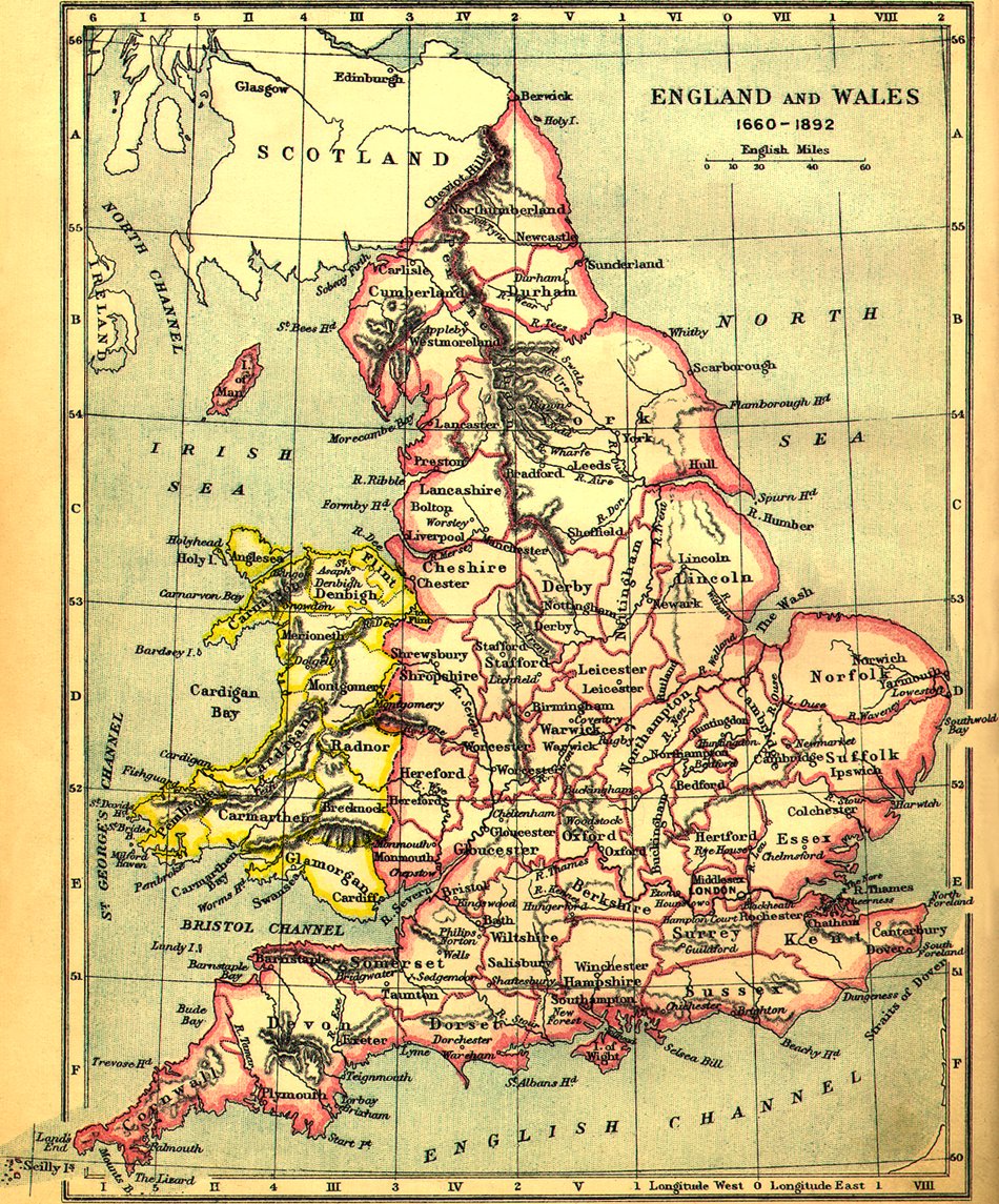 |
Map of England, depicting the times 1660 to 1892...
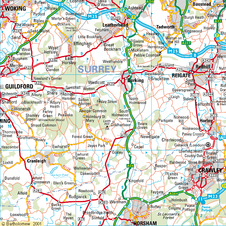 |
Modern map of Dorking Capel Surrey England. Each grid section is 10 km. square...